
11 November 2023
The Breda Formation is the oldest and therefore deepest unit in the Upper North Sea Group. Because of its relatively shallow burial (top depth between 0 and 600m) and therefore low temperature, it was not yet included in ThermoGIS. In the Roer Valley Graben (RVG) and the Zuiderzee Low (ZZL), the depth of the base exceeds 1000 meter. This corresponds to temperatures of more than 40°C which makes it a potential target for shallow geothermal production. The geothermal potential of the most promising parts of the RVG and ZZL areas was studied in the WarmingUP project.
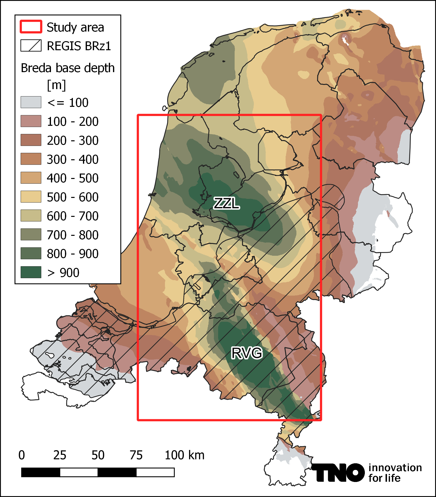
Figure 1 Breda Formation base depth, showing the depocenters Roer Valley Graben (RVG) and Zuiderzee Low (ZZL). REGIS sand (BRz1) distribution area hatched, outline of pilot area in red.
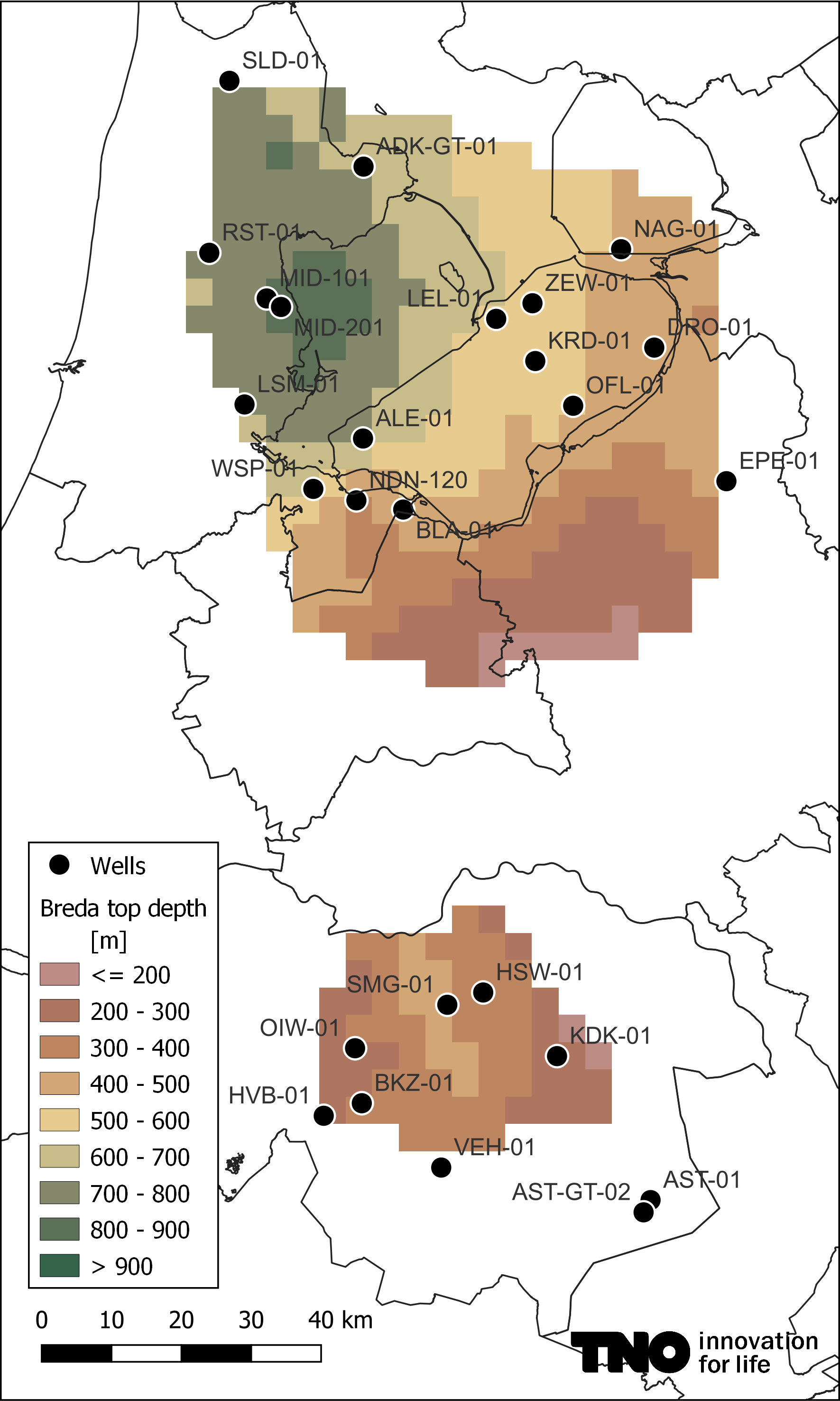
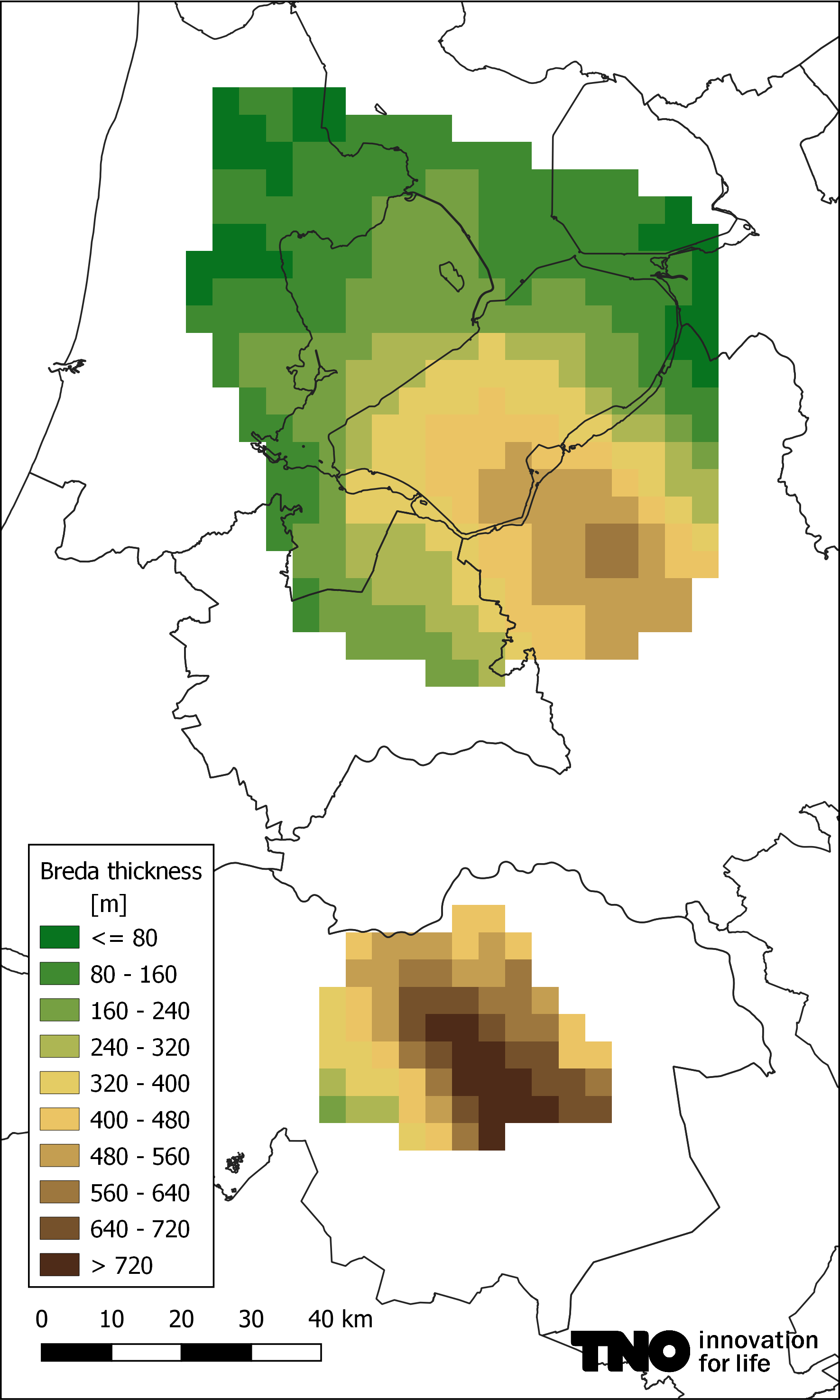
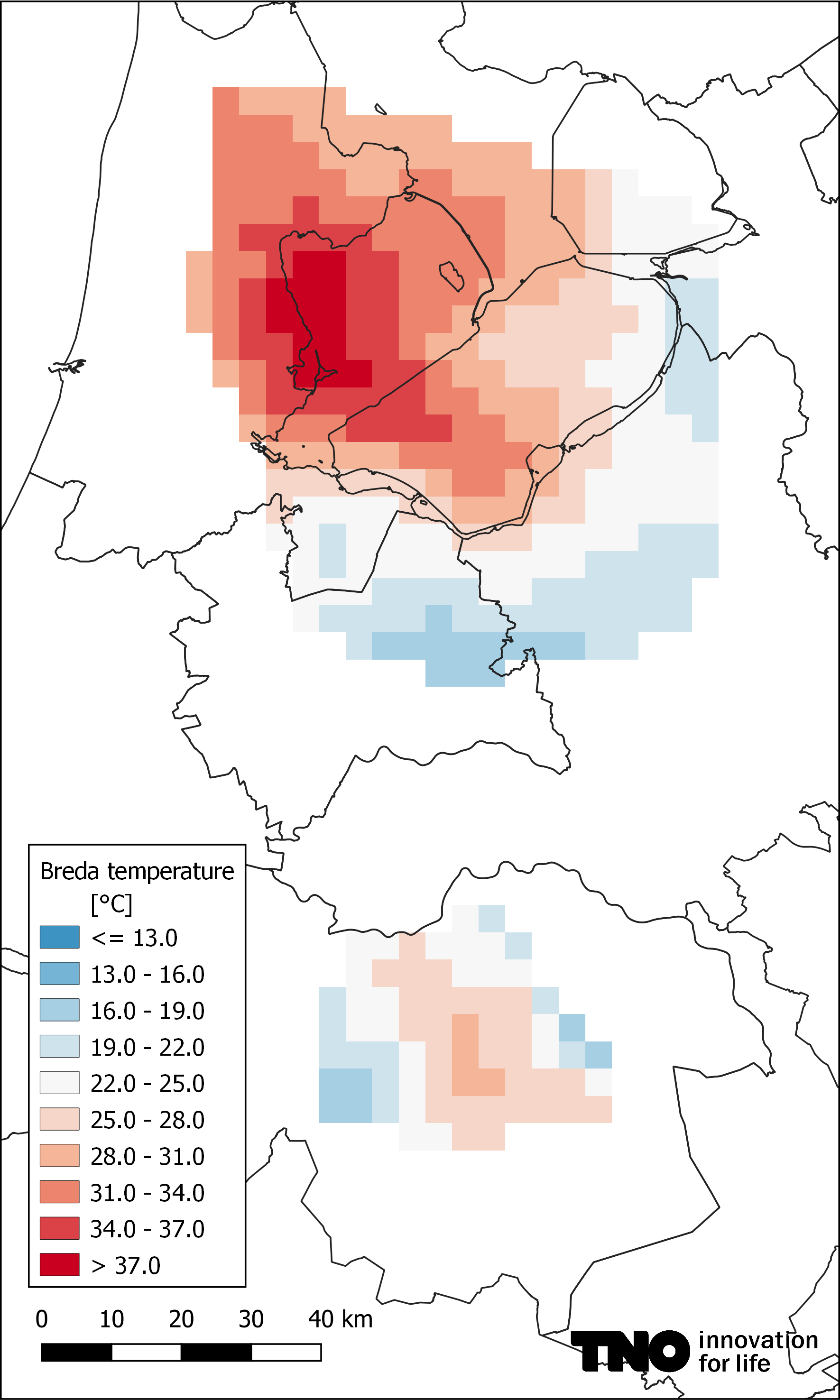
Figure 2 Breda Formation top depth, thickness and mid aquifer temperature, and wells used.
The geology of the depth range of several 100s of meters has long been overlooked because it is too deep for groundwater studies, and too shallow for O&G exploration. Therefore little data is available for the units that exist in this geological no-man's land. Based on sparse data, the REGIS model (REgional Geohydrological Information System) suggests that the Breda is only sandy in the southern part of the Netherlands around the RVG (BRz1 unit), bounded towards the northwest by the line Rotterdam – Utrecht – Zwolle. Northwest of this line, the Breda Formation is considered to consist mainly of clay.
The ZZL and RVG areas were depocenters during the deposition of the sediments of the Breda Formation. Within the WarmingUP project, the hypothesis was formulated that the Breda infill of the ZZL may also consist of sand.
In the ZZL area the top and bottom as well as an internal unconformity which splits the Breda Formation into the yet informal underlying Groote Heide and overlying Diessen units could be interpreted on seismic. For a part of the RVG, a similar seismic interpretation was already done with the H3O NW project. Cuttings from 5 wells were evaluated, and a petrophysical analysis was carried out for 9 wells in the RVG and 16 in the ZZL. The cuttings reveal that, in the ZZL, the Breda Formation is sandy, although it is difficult to establish the fines content and therefore the flow potential. Well test results from the sandy parts of the Breda Formation in the Naarden-120 well, which is located at the southern border of the ZZL and at the same time the northernmost occurrence of the REGIS Brz1 unit, reveal permeabilities slightly lower than 300 mD. The petrophysical evaluations for both areas shows that on average the permeability is between ~100 and ~3000 mD.
A geothermal potential was calculated using the ThermoGIS approach. Some changes were made to the 'standard' ThermoGIS calculation scenario to achieve more realistic results:
- The 30°C return temperature used in ThermoGIS is high when the production temperature does not exceed 40°C. It was therefore lowered to 20°C.
- When the total depth (TD) is relatively shallow, achieving a sufficient well separation at aquifer level to prevent early thermal breakthrough requires a different well development approach than for deep wells. The user defined maximum buildup rate must not be exceeded.
The ThermoGIS results show that the power that can be produced is up to about 9 MWth in both the Zuiderzee Low and the Roer Valley Graben. A heat pump could be used to increase this power.
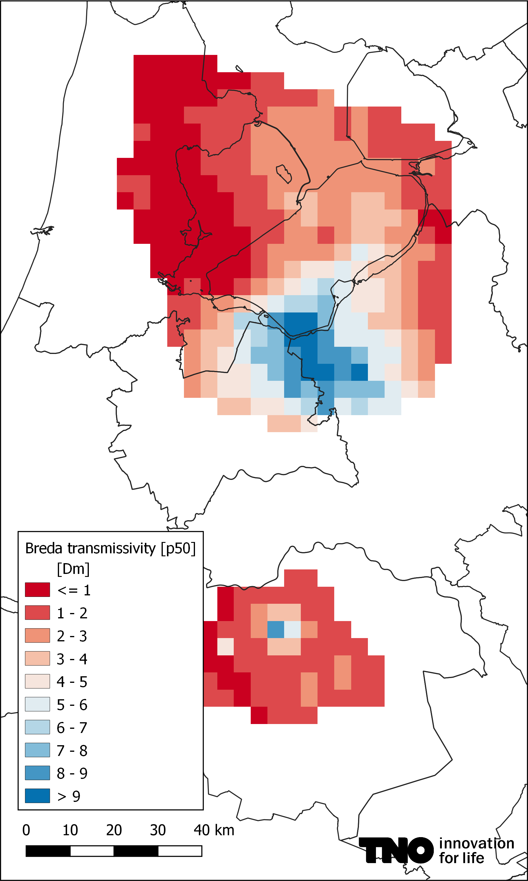
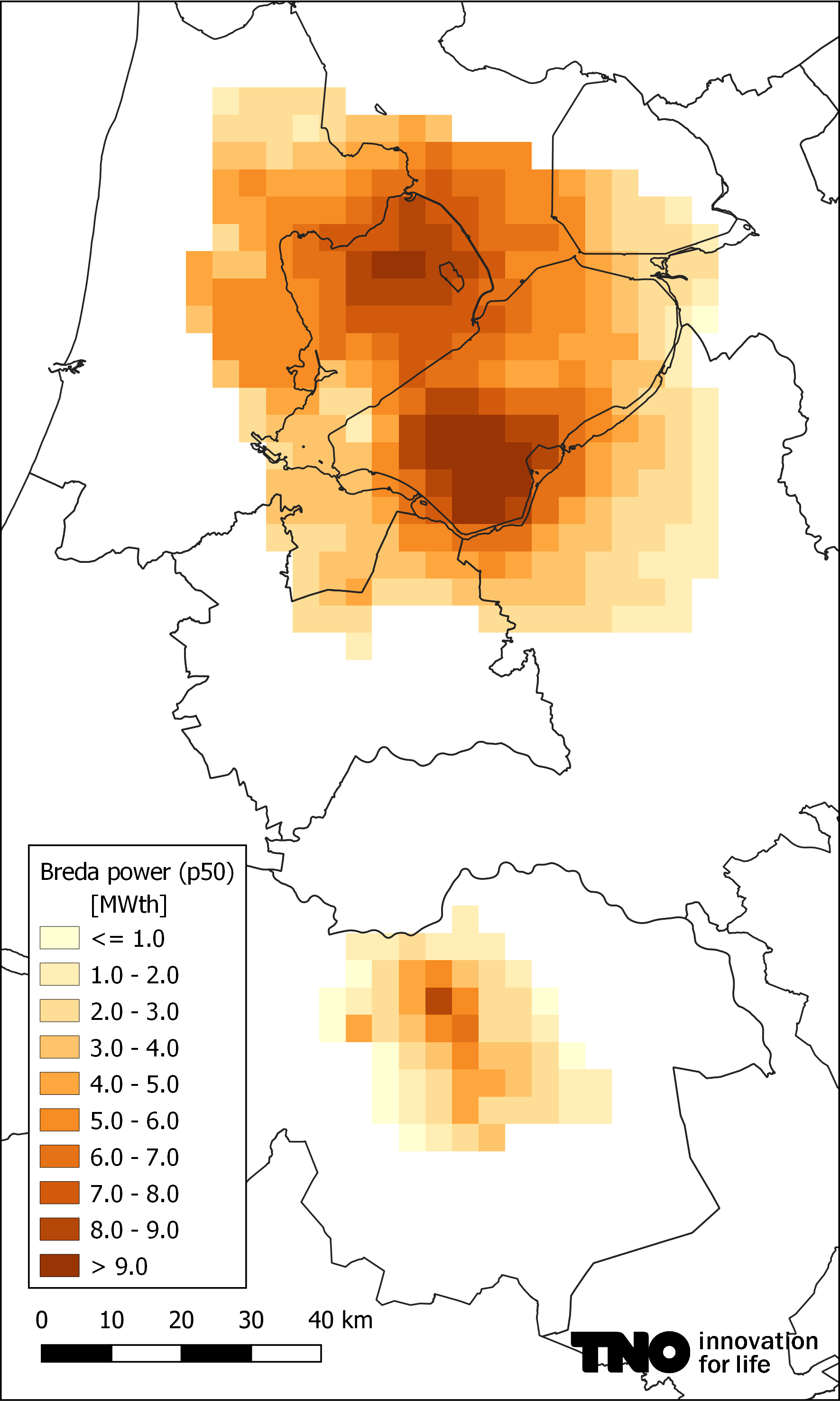
Figure 3 Breda transmissivity and power.
The followed ThermoGIS scenario assumes that the entire Breda thickness (sometimes up to 700 meters) is completed, which is not realistic. Also, the aquifer quality of the overlying Diessen is usually better than that of the underlying Groote Heide, and the Diessen is also much thicker. On the other hand, the aquifer temperature of the Groote Heide is higher. The power map must therefore be used with caution. In practice, it should be decided which part of the Breda is best completed, and how, after a local geological and geotechnical study. The best well design will probably include subhorizontal laterals, but this goes beyond the current capabilities of ThermoGIS. More realistic well designs and completions were modelled within the WarmingUP project of which the report can be downloaded using the link shown below.
It is TNOs intention to add the Breda sand to ThermoGIS in the near future.