Skip to main content Skip to footer
Thermogis
Geothermal mapping

Hoofdnavigatie

  • Map viewer
  • Technical Information
    • What is ThermoGIS?
    • Aquifers
    • Aquifer properties
    • Temperature model
    • Heat pumps
    • Data availability maps
    • Publications
    • Calculation model (geothermal energy)
    • Rekenmodel (HTO)
    • Maps
    • Versions
    • Request data
  • Map viewer information
  • New developments
    • Breda Formation
    • Application on shallow Brussels Sand
    • Aquifer Thermal Energy Storage (ATES)
  • Nederlands
  • What is ThermoGIS?
  • Aquifers
    • Areal extent, gross thickness and depth
    • Dinantian
  • Aquifer properties
    • Porosity and permeability
    • Net-to-gross
    • Stacked layers
  • Temperature model
  • Heat pumps
  • Data availability maps
  • Publications
  • Calculation model (geothermal energy)
    • DoubletCalc1D
    • Technical model
    • Economic model
    • Alternative scenarios
    • Doublet and economic parameters
  • Rekenmodel (HTO)
    • What is HT-ATES?
    • ROSIM-DoubletCalc3D
    • Technical model
    • Economic model
    • Doublet- and economic parameters
  • Maps
  • Versions
    • ThermoGIS v2.4, mei 2025
    • ThermoGIS v2.3, April 2024
    • ThermoGIS v2.2, November 2022
    • ThermoGIS v2.1, March 2019
    • ThermoGIS v2.0, October 2018
    • ThermoGIS v1, 2012
  • Request data

Technical information

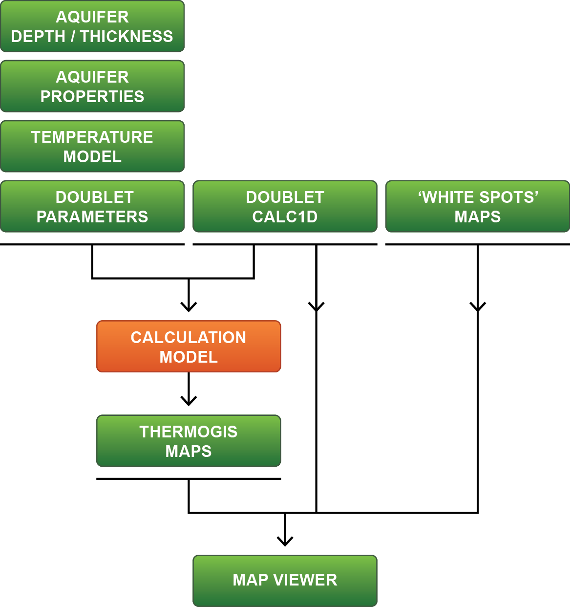
The following flowchart shows the ThermoGIS workflow. All elements are clickable for more information.

ThermoGIS Workflow

The ThermoGIS workflow has also been described in the following papers presented during the European Geothermal Congress 2019 ThermoGIS update: a renewed view on geothermal potential in the Netherlands and the World Geothermal Congress 2020+1 ThermoGIS: from a Static to a Dynamic Approach for National Geothermal Resource Information and Development.Aquifers Aquifer properties Temperature model Doublet parameters DoubletCalc1D 'White spots' maps Calculation model ThermoGIS maps Map viewer

Logo: TNO - innovation for life

ThermoGIS is developed and managed by TNO Geological Survey of The Netherlands.

Service

  • News
  • Contact
  • Disclaimer
  • Privacy statement
  • Cookies