
ThermoGIS is an online web tool showing maps of the potential of geothermal energy and HT-ATES. Geothermal energy is an amalgamation of the Greek “geo” (earth) and “thermos” (heat) and is also known as geothermal heat. It is a renewable energy source that is not weather- or season dependent. HT-ATES stands for High Temperature Aquifer Thermal Energy Storage, and is (seasonal) storage of heat in the subsurface.
ThermoGIS translates geological data and knowledge into a model of the subsurface. It shows maps of the depth, thickness, permeability and temperature of rock layers, from which geothermal heat can potentially be extracted or where the subsurface can be used for HT-ATES.
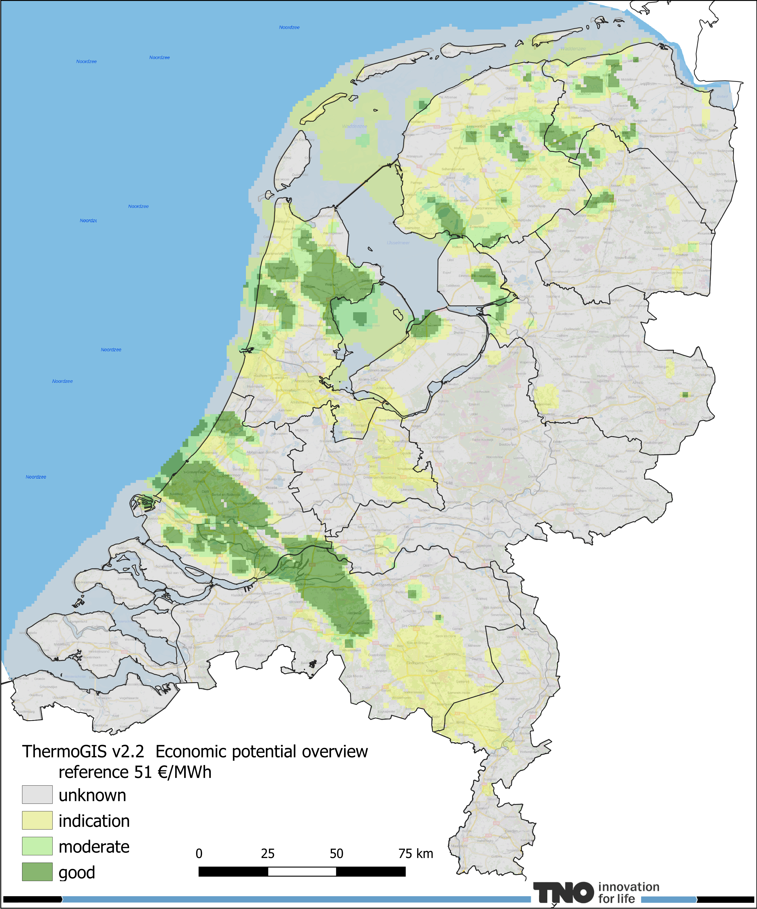
The geothermal and HT-ATES potential was calculated using a techno-economic calculation module. This takes into account both technical (how much heat can be produced) and economic aspects (what does it cost).
The potential maps of the Netherlands can be viewed using the Mapviewer (see the Tips & tricks page for help navigating the Mapviewer). Among other things, the potential maps show what the achievable flow rate can be, as well as the temperature of the production water or geothermal power. Finally, they indicate the approximate costs compared to the SDE++ base amount.
The “Calculation tab” of the Mapviewer allows the geothermal potential to be calculated for a specific location. The main parameters can be adjusted to calculate the potential for a specific location. The Technical Information page explains how the potential maps are made. The maps are publicly available and can be downloaded here.
ThermoGIS is developed by the Geological Survey of the Netherlands, part of TNO (TNO-GDN). The development uses subsurface knowledge and data available through NLOG. ThermoGIS is continuously updated, expanded and improved where necessary. You can read all about it at “New Developments”.
Disclaimer
ThermoGIS only shows strata with potential for geothermal and HT-ATES. The natural properties of these strata, also known as aquifers, are favourable enough to extract a sufficient amount of water. Mapping of strata depends partly on data availability and data density. It is therefore possible that certain layers are not included in ThermoGIS because not enough is known about them. The maps in ThermoGIS are mapped and modelled on a regional scale. Locally, the values shown may therefore differ from reality.
Once new data become available, as for instance from the SCAN programme, the map images may change. GDN-TNO aims to regularly update the maps in ThermoGIS.