|
|
Location information Click on the map to select a point; the selection tab will then be activated. Note: the ThermoGIS output values ('Selected' column) may differ from the calculated values when a probability of P90 or P10 or the heat pump scenario is selected (see warnings here). |
|
|
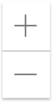
Zoom in/out Zoom in and out. With <shift><left mouse button>, a zoom rectangle can be drawn on the map. |
|
|
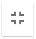
Full screen/embedded map viewer Full screen within the browser; the top black bar disappears. To also remove the browser bars (URL field, favorites, etc.) most browsers support the F11-key (browser full screen). Note: all data entered in the map viewer tabs will be lost when using this option. |
|
|
Cross section tool Draw a vertical cross section. Clicking on the button will activate the cross section tool. A line can be drawn by clicking on the map, where double clicking completes the line. Holding the left mouse button while moving creates a continuous curved line. The data displayed is from the DGM-Deep v4.0 model. |
|
|
Borehole tool See the geological column at a single location. Clicking on the button will activate the borehole tool. A location can be selected by clicking on any point on the map of the Netherlands. If no borehole information is found at the selected location, then the nearest data point within 100 meters will be given. If no borehole data is found within 100 meters, then a different point must be chosen. The data displayed is from the DGM-Deep v4.0 model. |

 + (on calculation tab)
  +
+